

Maritime
Map
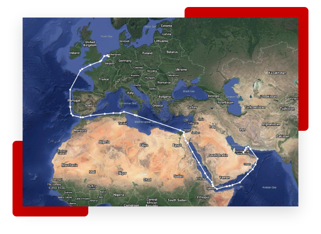
With our real-time tracking and mapping data you can analyse current and historical movements of vessels, fleets and customisable portfolios against GIS overlays of territorial waters, offshore infrastructure, renewables and personalised zones. Our email alerts and saveable searches will save you time in complying with regulations and planning projects.
Monitor the global fleet
Available for the Shipping, Offshore, and Passenger sectors.
Satellite and terrestrial AIS positions
AIS & GIS data
Historical tracking
Unlimited searches
Sanctions monitoring
Offshore and Green infrastructure
Follow the market in real-time with our values
Access live, newbuild and historical values for individual vessels, company fleets and portfolios. View and compare across several valuation types.
Real-time mapping & tracking intelligence
- Analyse current and historical vessel, fleet and portfolio movements
- Historical tracking back to 2013
- View detailed fleet searches including by vessel specification, ownership, destination, ETA, navigation status, laden or ballast
- Refine your searches even further
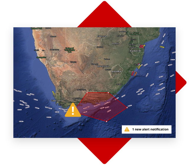
Stay alert and informed
- Set up alerts to receive notifications when vessels enter specific areas of interest including sanctioned zones
- See if vessels have turned off AIS transponders (and if vessels could have reached a particular region or zone since they turned it off)
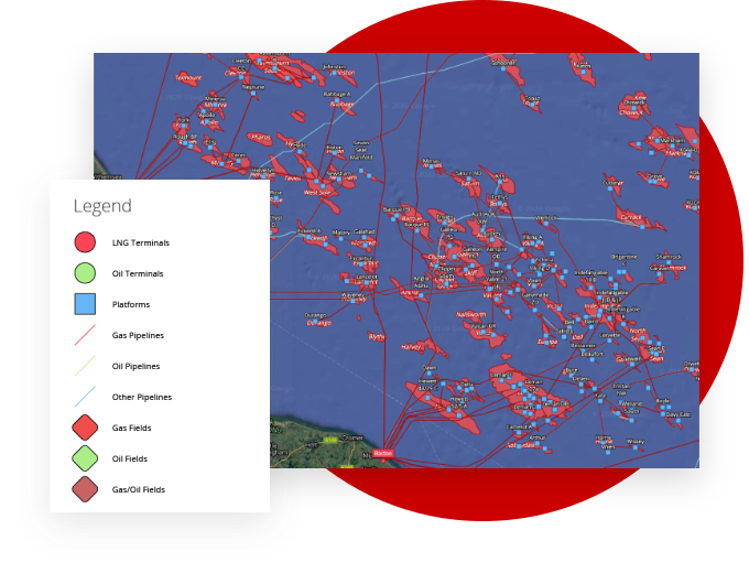
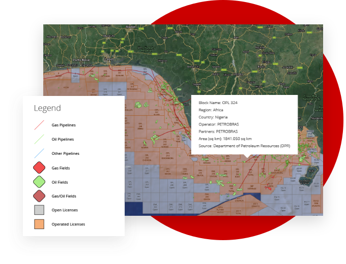
View and filter Oil & Gas installations including oil and gas fields, terminals, open and operated licenses, wells, platforms, pipelines, refineries plus upcoming prospects and recent discoveries. All with corresponding operator and ownership data.
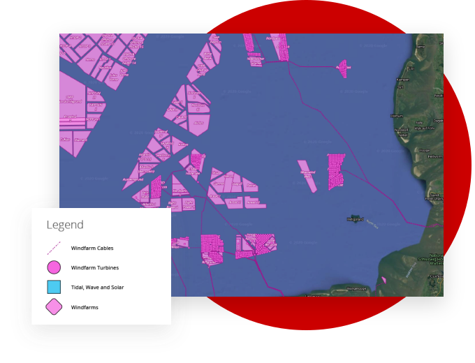
See layouts and installations related to Renewables, Aquaculture and Commodities such as coal, aluminium, iron, steel, and other mineral mines. Renewables include windfarm locations and installation layouts including turbine, substation, and cable locations plus tidal, solar and wave hubs. With added information showing MW capacities, operators, turbine manufacturer and model.
See the ownership structure of operated and open licenses and the details behind each infrastructure. Identify vessel locations in relation to Offshore installations.
Track activity between ports
- View the amount of time, nautical miles or speeds from one port to another
- Includes multiple legs, route options and turnaround time
Here are just some of the benefits
Clean satellite and terrestrial AIS positions
Multi source data, updated every 15 minutes, cleaned and validated by our 20 person specialist team.
Related to accurate vessel database
AIS data provided with our proprietary vessel database. Filter and display fleet by hundreds of criteria including 7 layers of ownership.
Marine infrastructure
Understand current and historical market trends for individual vessels, fleets, companies or whole sectors.
Sanctions
See when vessels enter sanctioned zones and territorial waters. Set up alerts when vessels turn off AIS transponders or travel to specific areas.
Want to know more?
Request a demo and start making informed decisions.